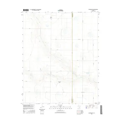
2016 Map of Wildorado SW
USGS Topo · Published 2016About this map
The canyon systems of the N Palo Duro Cr and Palo Duro Cr dominate this portion of the Texas Panhandle, cutting through the high plains along the border of Deaf Smith and Randall counties. This landscape is defined by the intersection of traditional ranching geography and modern aviation infrastructure, notably at the Kimball Farm Service Inc Airport near Ranch Rd 809. Local history is anchored at the Palo Duro Wildorado Cem, which stands as a quiet marker of the region's early rural communities. The drainage patterns around Roy Gwyn Ranch Lake illustrate the seasonal hydrology of the region, while a network of rural routes like W Costley Rd and Westline Rd connects the high-plateau farms and ranches that characterize this part of the Llano Estacado.
Find a feature on this map
23 named features on this map. Tap any name to fly to it.
Don’t see what you’re looking for? This feature index may not catch every label — zoom into the map to look around manually.
Map Details
Editions of this 2016 Wildorado SW Map
This is the sole edition of this map. No revisions or reprints were ever made.
Other maps of this area

1954 · Tucumcari
USGS Topo · 1:250,000

1954 · Clovis
USGS Topo · 1:250,000

1958 · Clovis
USGS Topo · 1:250,000

1958 · Tucumcari
USGS Topo · 1:250,000

1961 · Buffalo Lake
USGS Topo · 1:62,500

1962 · Wildorado
USGS Topo · 1:62,500

1965 · Everett
USGS Topo · 1:24,000

1965 · Allison Ranch
USGS Topo · 1:24,000

1971 · Hereford NE
USGS Topo · 1:24,000
1984 · Bivins Lake
USGS Topo · 1:24,000