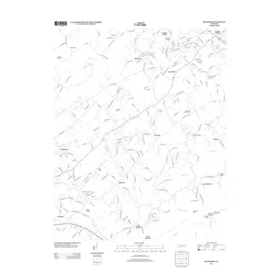
2013 Map of Wildwood
USGS Topo · Published 2013About this map
Chilhowee Mountain rises along the southeastern edge of this terrain, anchored by the Millstone Gap Lookout Tower and Camp Chilhowee. The landscape is a network of small valley settlements and watercourses, where the Little River flows past Fairfield and numerous creeks like Ellejoy Cr and Nails Cr drain the ridges. In the early 21st century, the area shows a transition from traditional rural life to modern aviation interests, evidenced by Into the Wind Airport and Seymour Air Park, Inc..
Find a feature on this map
213 named features on this map. Tap any name to fly to it.
Don’t see what you’re looking for? This feature index may not catch every label — zoom into the map to look around manually.
Map Details
Editions of this 2013 Wildwood Map
This is the sole edition of this map. No revisions or reprints were ever made.
Other maps of this area

1886 · Knoxville
USGS Topo · 1:125,000

1892 · Knoxville
USGS Topo · 1:125,000

1894 · Knoxville
USGS Topo · 1:125,000

1895 · Knoxville
USGS Topo · 1:125,000

1901 · Knoxville
USGS Topo · 1:125,000

1935 · Knoxville
USGS Topo · 1:48,000

1935 · Walden Creek
USGS Topo · 1:24,000

1935 · Maryville
USGS Topo · 1:24,000

1935 · Wildwood
USGS Topo · 1:24,000
1935 · Blockhouse
USGS Topo · 1:24,000