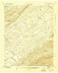
1941 Map of Wildwood
USGS Topo · Published 1941About this map
Bays Mountains and the heights of Chilhowee Mountain frame a landscape of agrarian settlements and rural congregations in this 1941 survey. The valley floor is defined by the winding course of the Little River, where Davis Ford provides a crossing near the Gaging Station. A high density of rural institutions reflects the community life of the era, from the Klondike Sch in the north to the Old Chilhowee Sch and Keeble Chapel in the southern hills. Notable infrastructure including the Chapman Highway cuts through the northeast, while numerous watercourses like Ellejoy Creek and Nails Creek drain the ridges. The map meticulously records the intersection of Knox, Blount, and Sevier counties, showing the early 20th-century distribution of homesteads and small centers like Wildwood and Prospect.
Find a feature on this map
44 named features on this map. Tap any name to fly to it.
Don’t see what you’re looking for? This feature index may not catch every label — zoom into the map to look around manually.
Map Details
Editions of this 1941 Wildwood Map
This is the sole edition of this map. No revisions or reprints were ever made.
Other maps of this area

1886 · Knoxville
USGS Topo · 1:125,000

1892 · Knoxville
USGS Topo · 1:125,000

1894 · Knoxville
USGS Topo · 1:125,000

1895 · Knoxville
USGS Topo · 1:125,000

1901 · Knoxville
USGS Topo · 1:125,000

1935 · Knoxville
USGS Topo · 1:48,000

1935 · Walden Creek
USGS Topo · 1:24,000

1935 · Maryville
USGS Topo · 1:24,000

1935 · Wildwood
USGS Topo · 1:24,000
1935 · Blockhouse
USGS Topo · 1:24,000