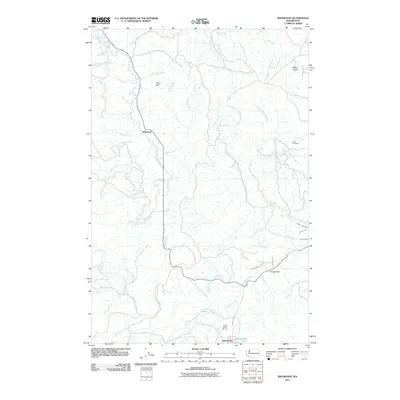
2011 Map of Wildwood
USGS Topo · Published 2011About this map
The South Fork Chehalis River carves a central path through this Lewis County landscape, serving as the primary drainage for a dense network of tributaries including Lentz Creek, Cedar Creek, and Black Creek. The small settlement of Wildwood sits along the river's upper reaches, while the town of Ryderwood anchors the southern portion of the sheet near Ryderwood Pond. This 2011 survey reveals a landscape defined by its timber and water resources, with significant elevation markers like Point Hill and the Stony Grade overlooking the creek valleys. Local history is preserved at the Snow Cemetery in the northeast, while rural access is maintained through a web of named tracks such as Brim Creek Rd and Hendrickson Rd. The mapping of Cougar Flat and numerous small drainages like Root House Creek and Slide Creek illustrates the complex hydrology of this part of the Pacific Northwest.
Find a feature on this map
41 named features on this map. Tap any name to fly to it.
Don’t see what you’re looking for? This feature index may not catch every label — zoom into the map to look around manually.
Map Details
Editions of this 2011 Wildwood Map
This is the sole edition of this map. No revisions or reprints were ever made.
Other maps of this area

1916 · Chehalis
USGS Topo · 1:125,000

1941 · Meskill
USGS Topo · 1:62,500

1941 · Olequa
USGS Topo · 1:62,500

1953 · Hoquiam
USGS Topo · 1:250,000

1953 · Castle Rock
USGS Topo · 1:62,500

1953 · Ryderwood
USGS Topo · 1:62,500

1953 · Adna
USGS Topo · 1:62,500

1954 · Centralia
USGS Topo · 1:62,500

1957 · Hoquiam
USGS Topo · 1:250,000

1958 · Hoquiam
USGS Topo · 1:250,000