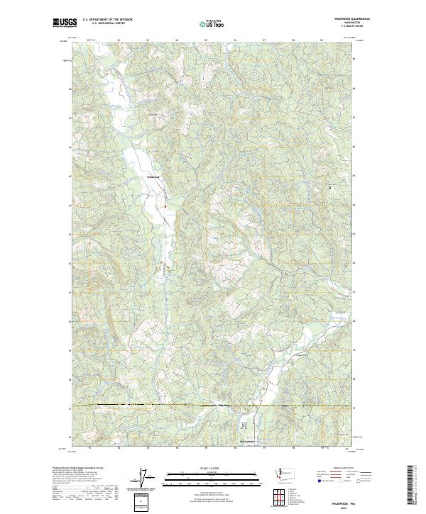
2023 Map of Wildwood
USGS Topo · Published 2023About this map
The South Fork Chehalis River carves through the landscape near the small community of Wildwood, where numerous tributaries like Wilson Creek and Sep Creek feed into the main waterway. This 2023 survey illustrates the rugged drainage patterns of the region, defining the transition from the Lewis County highlands into the northern reaches of Cowlitz County. To the south, the settlement of Ryderwood sits adjacent to Ryderwood Pond and Campbell Creek, serving as a primary local hub at the foot of Pumphrey Mtn. The map traces a network of timber and access roads, including Wildwood Rd and Brim Creek Rd, which navigate the steep elevations of Stony Grade and Point Hill. Family history researchers can locate the Snow Cem in the northeast, a quiet landmark situated near the headwaters of the North Fork Brim Creek and Laughlin Creek.
Find a feature on this map
48 named features on this map. Tap any name to fly to it.
Don’t see what you’re looking for? This feature index may not catch every label — zoom into the map to look around manually.
Map Details
Editions of this 2023 Wildwood Map
This is the sole edition of this map. No revisions or reprints were ever made.
Other maps of this area

1916 · Chehalis
USGS Topo · 1:125,000

1941 · Meskill
USGS Topo · 1:62,500

1941 · Olequa
USGS Topo · 1:62,500

1953 · Hoquiam
USGS Topo · 1:250,000

1953 · Castle Rock
USGS Topo · 1:62,500

1953 · Ryderwood
USGS Topo · 1:62,500

1953 · Adna
USGS Topo · 1:62,500

1954 · Centralia
USGS Topo · 1:62,500

1957 · Hoquiam
USGS Topo · 1:250,000

1958 · Hoquiam
USGS Topo · 1:250,000