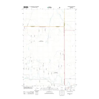
2013 Map of Wildwood SE
USGS Topo · Published 2013About this map
The Chippewa National Forest dominates this landscape in northern Minnesota, where the Big Fork River winds through the southern reaches of the quadrangle. A significant geographic boundary is documented here, as the line between Koochiching Co and Itasca Co runs east-to-west across the northern portion of the sheet. The river's path is marked by Hauck Rapids, providing a specific point of reference for river navigation and local hydrology.
Find a feature on this map
35 named features on this map. Tap any name to fly to it.
Don’t see what you’re looking for? This feature index may not catch every label — zoom into the map to look around manually.
Map Details
Editions of this 2013 Wildwood SE Map
This is the sole edition of this map. No revisions or reprints were ever made.
Other maps of this area

1918 · Zora
USGS Topo · 1:62,500

1919 · Zora
USGS Topo · 1:62,500

1919 · Marcell
USGS Topo · 1:62,500

1954 · Hibbing
USGS Topo · 1:250,000

1957 · Hibbing
USGS Topo · 1:250,000

1958 · Hibbing
USGS Topo · 1:250,000

1964 · Hibbing
USGS Topo · 1:250,000
1970 · Spring Lake
USGS Topo · 1:24,000
1970 · Bigfork
USGS Topo · 1:24,000
1970 · Wirt
USGS Topo · 1:24,000