
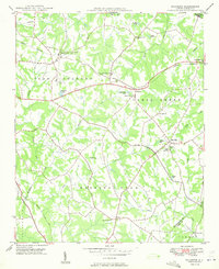
1949 Map of Wilgrove
USGS Topo · Published 1949About this map
The town of Mint Hill and its surrounding rural townships in Mecklenburg County appear at a pivotal moment of mid-century development. Established community hubs like Hickory Grove and Wilgrove are connected by a network of local roads including Lawyers Road, while the tracks of the Norfolk Southern and Seaboard Air Line railroads define the area's logistical landscape. Cultural anchors of the era are clearly visible, including Bain High Sch and several country churches such as Morning Star Ch and True Light Ch.
Find a feature on this map
43 named features on this map. Tap any name to fly to it.
Don’t see what you’re looking for? This feature index may not catch every label — zoom into the map to look around manually.
Map Details
Editions of this 1949 Wilgrove Map
2 editions found
Other maps of this area

1905 · Charlotte
USGS Topo · 1:48,000

1907 · Charlotte
USGS Topo · 1:62,500

1941 · Charlotte
USGS Topo · 1:125,000

1942 · Charlotte
USGS Topo · 1:125,000

1948 · Derita
USGS Topo · 1:24,000

1948 · Charlotte East
USGS Topo · 1:24,000

1949 · Charlotte East
USGS Topo · 1:24,000

1949 · Harrisburg
USGS Topo · 1:24,000

1949 · Midland
USGS Topo · 1:24,000

1949 · Concord SE
USGS Topo · 1:24,000