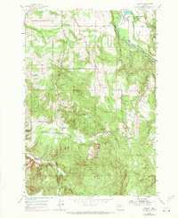
1955 Map of Wilhoit
USGS Topo · Published 1971About this map
The Molalla River cuts through this pocket of the Oregon Cascades foothills, where the 1970 photorevisions highlight a landscape of timber production and rural education. Central to the area is the community of Wilhoit, situated near the confluence of several mountain drainages. The distribution of Dickey Prairie Sch, the Maple Grove School, and the Beaver Lake Sch suggests a once-active network of rural districts serving family farms and logging camps, while the Wildcat School (Aband) reflects the mid-century shift toward school consolidation.
Find a feature on this map
41 named features on this map. Tap any name to fly to it.
Don’t see what you’re looking for? This feature index may not catch every label — zoom into the map to look around manually.
Map Details
Editions of this 1955 Wilhoit Map
4 editions found
Other maps of this area

1916 · Estacada
USGS Topo · 1:125,000

1929 · Mill City
USGS Topo · 1:125,000

1939 · Molalla
USGS Topo · 1:62,500

1940 · Molalla
USGS Topo · 1:62,500

1948 · Vancouver
USGS Topo · 1:250,000

1950 · Vancouver
USGS Topo · 1:250,000

1950 · Vancouver
USGS Topo · 1:250,000

1951 · Lyons
USGS Topo · 1:62,500

1953 · Salem
USGS Topo · 1:250,000

1954 · Salem
USGS Topo · 1:250,000