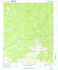
1969 Map of Wilhoit
USGS Topo · Published 1979About this map
Mining operations and water management define this portion of the Prescott National Forest in the late 1960s. The settlement of Wilhoit sits along the primary roadway, while the landscape is dotted with historical extraction points including the Mint Shaft, White Spar Mine, and Climax Mine. This area within the Copper Basin shows a distinct transition from the high elevations of Quartz Mtn down to the Hassayampa River, where evidence of large-scale mineral processing appears as Dredge Tailings. Dozens of springs and windmills, such as the Telegraph Spring Windmill and Copper Creek Windmill, indicate the vital infrastructure required for both ranching and mining in this arid environment. Collectors and researchers can also locate the Glen Oaks (Site), appearing here as a remnant of earlier habitation.
Find a feature on this map
53 named features on this map. Tap any name to fly to it.
Don’t see what you’re looking for? This feature index may not catch every label — zoom into the map to look around manually.
Map Details
Editions of this 1969 Wilhoit Map
3 editions found
Other maps of this area

1887 · Prescott
USGS Topo · 1:250,000

1892 · Prescott
USGS Topo · 1:250,000

1903 · Bradshaw Mountains
USGS Topo · 1:125,000

1903 · Congress
USGS Topo · 1:125,000

1904 · Congress
USGS Topo · 1:125,000

1905 · Jerome
USGS Topo · 1:125,000

1947 · Iron Springs
USGS Topo · 1:62,500

1947 · Mt. Union
USGS Topo · 1:62,500

1947 · Kirkland
USGS Topo · 1:62,500

1947 · Prescott
USGS Topo · 1:62,500