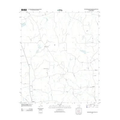
2013 Map of Wilkerson Mountain
USGS Topo · Published 2013About this map
Montalba serves as a primary hub in this rural Anderson County landscape, situated at the junction of FM-321 and State Highway 19. The terrain is defined by low-lying wetlands and modest elevations, including Wilkerson Mountain and Pine Mtn. Water drainage patterns are clearly visible through the winding courses of Mound Prairie Cr and Beaver Cr, the latter of which feeds into the Beaver Marsh.
Find a feature on this map
47 named features on this map. Tap any name to fly to it.
Don’t see what you’re looking for? This feature index may not catch every label — zoom into the map to look around manually.
Map Details
Editions of this 2013 Wilkerson Mountain Map
This is the sole edition of this map. No revisions or reprints were ever made.
Other maps of this area

1949 · Palestine
USGS Topo · 1:62,500

1949 · Frankston
USGS Topo · 1:62,500

1949 · Athens
USGS Topo · 1:62,500

1949 · Tennessee Colony
USGS Topo · 1:62,500

1950 · Athens
USGS Topo · 1:62,500

1950 · Palestine
USGS Topo · 1:62,500

1950 · Frankston
USGS Topo · 1:62,500

1950 · Tennessee Colony
USGS Topo · 1:62,500

1953 · Palestine
USGS Topo · 1:250,000

1956 · Tyler
USGS Topo · 1:250,000