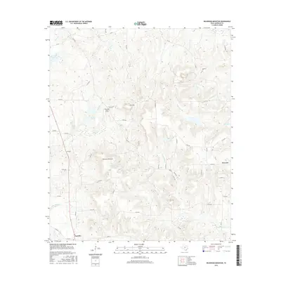
2016 Map of Wilkerson Mountain
USGS Topo · Published 2016About this map
Wilkerson Mountain and Pine Mtn dominate the topography of this Anderson County landscape, rising above a network of creek drainages that feed into the Neches River watershed. The settlement of Montalba sits in the southwestern corner, serving as a historic crossroads where several county roads and FM routes converge. To the northeast, the smaller community of Elmwood is situated near the headwaters of Walnut Creek.
Find a feature on this map
53 named features on this map. Tap any name to fly to it.
Don’t see what you’re looking for? This feature index may not catch every label — zoom into the map to look around manually.
Map Details
Editions of this 2016 Wilkerson Mountain Map
This is the sole edition of this map. No revisions or reprints were ever made.
Other maps of this area

1949 · Palestine
USGS Topo · 1:62,500

1949 · Frankston
USGS Topo · 1:62,500

1949 · Athens
USGS Topo · 1:62,500

1949 · Tennessee Colony
USGS Topo · 1:62,500

1950 · Athens
USGS Topo · 1:62,500

1950 · Palestine
USGS Topo · 1:62,500

1950 · Frankston
USGS Topo · 1:62,500

1950 · Tennessee Colony
USGS Topo · 1:62,500

1953 · Palestine
USGS Topo · 1:250,000

1956 · Tyler
USGS Topo · 1:250,000