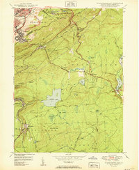
1950 Map of Wilkes-Barre East
USGS Topo · Published 1950About this map
Wilkes Barre Mountain and Wyoming Mountain dominate this mid-century landscape, framing the industrial and residential growth east of the city core. The map documents an era when extractive industry and recreational retreats existed in close proximity. Multiple strip mines are visible near Boulevard Manor and Georgetown, while further south, the terrain shifts toward high-elevation wetlands and lakes including Crystal Lake and Bear Creek Lake.
Find a feature on this map
63 named features on this map. Tap any name to fly to it.
Don’t see what you’re looking for? This feature index may not catch every label — zoom into the map to look around manually.
Map Details
Editions of this 1950 Wilkes-Barre East Map
2 editions found
Other maps of this area

1889 · Scranton
USGS Topo · 1:62,500

1891 · Wilkesbarre
USGS Topo · 1:62,500

1891 · Scranton
USGS Topo · 1:62,500

1893 · Pittston
USGS Topo · 1:62,500

1893 · Scranton
USGS Topo · 1:62,500

1894 · Wilkesbarre
USGS Topo · 1:62,500

1922 · Stoddartsville
USGS Topo · 1:62,500

1924 · Stoddartsville
USGS Topo · 1:62,500

1943 · Scranton
USGS Topo · 1:125,000

1943 · Stoddartsville
USGS Topo · 1:62,500