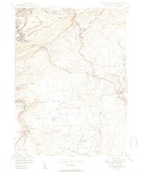
1950 Map of Wilkes-Barre East
USGS Topo · Published 1950About this map
Wilkes-Barre anchors the northwestern corner of this study, revealing a landscape defined by the transition from industrial urban centers to the high ridges of the Wyoming Valley. In the years following the war, the region's coal legacy is evidenced by strip mines and mine dumps carved into the slopes of Wilkes-Barre Mountain. This rugged topography creates a natural barrier between the city and the high plateaus to the southeast, where clusters like Oliver Mills and Llewellyn Corners stand near the Lehigh Valley Railroad.
Find a feature on this map
61 named features on this map. Tap any name to fly to it.
Don’t see what you’re looking for? This feature index may not catch every label — zoom into the map to look around manually.
Map Details
Editions of this 1950 Wilkes-Barre East Map
2 editions found
Other maps of this area

1889 · Scranton
USGS Topo · 1:62,500

1891 · Wilkesbarre
USGS Topo · 1:62,500

1891 · Scranton
USGS Topo · 1:62,500

1893 · Pittston
USGS Topo · 1:62,500

1893 · Scranton
USGS Topo · 1:62,500

1894 · Wilkesbarre
USGS Topo · 1:62,500

1922 · Stoddartsville
USGS Topo · 1:62,500

1924 · Stoddartsville
USGS Topo · 1:62,500

1943 · Scranton
USGS Topo · 1:125,000

1943 · Stoddartsville
USGS Topo · 1:62,500