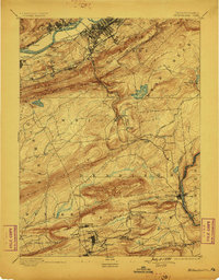
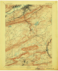
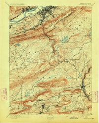
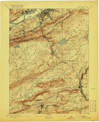
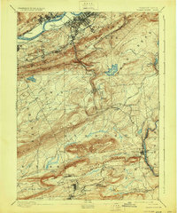
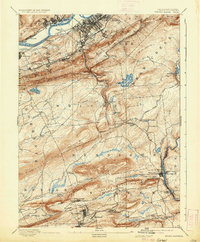
1894 Map of Wilkesbarre
USGS Topo · Published 1899About this map
Wilkesbarre serves as the industrial and transit hub of this late 19th-century landscape, where the anthracite coal trade is etched into the topography. The dense network of rail lines, including the Bloomsburg Division and Lehigh Valley R. R., mirrors the jagged ridges of Wilkesbarre Mountain and Penobscot Mountain. The settlement pattern reveals the distinct social geography of the era, from established centers like Plymouth and Nanticoke to smaller mining-affiliated clusters such as Moffat Patch, Askam, and Peely.
Find a feature on this map
80 named features on this map. Tap any name to fly to it.
Don’t see what you’re looking for? This feature index may not catch every label — zoom into the map to look around manually.
Map Details
Editions of this 1894 Wilkesbarre Map
8 editions found


Other maps of this area

1889 · Scranton
USGS Topo · 1:62,500

1889 · Hazleton
USGS Topo · 1:62,500

1891 · Wilkesbarre
USGS Topo · 1:62,500

1891 · Hazleton
USGS Topo · 1:62,500

1891 · Scranton
USGS Topo · 1:62,500

1891 · Harveys Lake
USGS Topo · 1:62,500

1892 · Mahanoy
USGS Topo · 1:62,500

1893 · Hazleton
USGS Topo · 1:62,500

1893 · Harvey Lake
USGS Topo · 1:62,500

1893 · Pittston
USGS Topo · 1:62,500