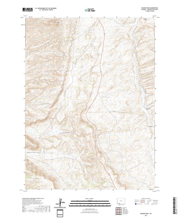
2021 Map of Wilkins Peak
USGS Topo · Published 2021About this map
Wilkins Peak and Flattop Mtn dominate this high-desert landscape in Sweetwater County, where the terrain is deeply etched by a network of drainage systems. The map traces the winding course of Little Bitter Cr and its associated features like the Sand Wash, alongside numerous geological depressions including Rock Canyon and Little Mellor Canyon. A sparse but functional network of routes, including Pipeline Rd, Little Firehole Rd, and Slippery Jim Canyon Rd, provides access through the complex topography of the high plains. The drainage patterns here, notably Little Firehole Canyon and Middle Firehole Canyon, illustrate the erosional forces that have shaped this portion of the Wyoming basins. This survey offers a clear view of the land as it remained in the early 21st century, largely defined by its natural landforms and the infrastructure required to traverse them.
Find a feature on this map
21 named features on this map. Tap any name to fly to it.
Don’t see what you’re looking for? This feature index may not catch every label — zoom into the map to look around manually.
Map Details
Editions of this 2021 Wilkins Peak Map
This is the sole edition of this map. No revisions or reprints were ever made.
Other maps of this area

1908 · Rock Springs
USGS Topo · 1:62,500

1910 · Rock Springs
USGS Topo · 1:62,500

1954 · Rock Springs
USGS Topo · 1:250,000

1957 · Firehole Basin
USGS Topo · 1:62,500

1958 · Rock Springs
USGS Topo · 1:250,000

1961 · Kanda
USGS Topo · 1:24,000

1961 · Green River
USGS Topo · 1:24,000

1962 · Rock Springs
USGS Topo · 1:250,000

1966 · Firehole Basin
USGS Topo · 1:62,500
1968 · Earnest Butte
USGS Topo · 1:24,000