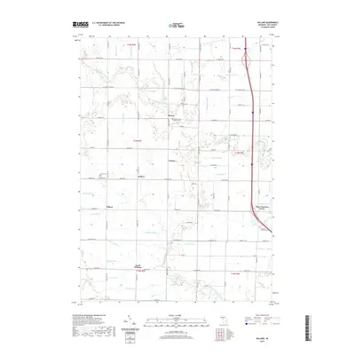
2019 Map of Willard
USGS Topo · Published 2019About this map
Beaver and Willard serve as central nodes in this rural Bay County landscape, where the agricultural grid is etched with an intricate network of drainage systems. These man-made and improved waterways, including the Renner Drain, Kaiser Drain, and Waldo Drain, speak to the historical effort required to manage the low-lying terrain for cultivation. The map captures several small settlement clusters such as Seidlers, Loehme, and Three Churches Corner, which reflect a dispersed but community-oriented social structure. Religious and genealogical heritage is clearly marked at sites like the Saint Valentine Catholic Cem and Apostolic Christian Cem. The natural hydrology of the Kawkawlin River and its North Branch Kawkawlin River provides the primary relief from the rigid township and range lines, defining the movement of water toward the Saginaw Bay watershed.
Find a feature on this map
98 named features on this map. Tap any name to fly to it.
Don’t see what you’re looking for? This feature index may not catch every label — zoom into the map to look around manually.
Map Details
Editions of this 2019 Willard Map
This is the sole edition of this map. No revisions or reprints were ever made.
Other maps of this area

1916 · Bay City
USGS Topo · 1:62,500

1919 · Bay City
USGS Topo · 1:62,500

1943 · Bay City
USGS Topo · 1:62,500

1954 · Midland
USGS Topo · 1:250,000

1954 · Flint
USGS Topo · 1:250,000

1958 · Flint
USGS Topo · 1:250,000

1958 · Midland
USGS Topo · 1:250,000

1959 · Midland
USGS Topo · 1:250,000

1962 · Willard
USGS Topo · 1:24,000

1962 · Midland South
USGS Topo · 1:24,000