
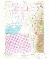
1955 Map of Willard
USGS Topo · Published 1956About this map
Brigham City and the neighboring settlements of Perry and Willard are positioned between the steep drainages of the Cache National Forest and the broad expanse of the Bear River Migratory Bird Refuge. The mid-1950s landscape is defined by the critical infrastructure of the Union Pacific corridor and the Old Railroad Grade, which navigate the narrow strip of habitable land beneath canyons like Mathias Canyon and Evans Canyon.
Find a feature on this map
34 named features on this map. Tap any name to fly to it.
Don’t see what you’re looking for? This feature index may not catch every label — zoom into the map to look around manually.
Map Details
Editions of this 1955 Willard Map
2 editions found
Other maps of this area

1914 · Logan
USGS Topo · 1:125,000

1916 · Logan
USGS Topo · 1:125,000

1954 · Whistler Canal
USGS Topo · 1:24,000

1954 · Ogden
USGS Topo · 1:250,000

1954 · Brigham City
USGS Topo · 1:250,000

1955 · Plain City
USGS Topo · 1:24,000

1955 · Mantua
USGS Topo · 1:24,000

1955 · Plain City SW
USGS Topo · 1:24,000

1955 · Bear River City
USGS Topo · 1:24,000

1955 · North Ogden
USGS Topo · 1:24,000