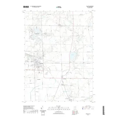
2019 Map of Willard
USGS Topo · Published 2019About this map
The agricultural heart of Huron County surrounds the city of Willard, which serves as a central hub for the surrounding settlements of New Haven, Celeryville, and Steuben. The landscape is intricately carved by the West Branch Huron River and the W Br Huron River, supporting a rich network of farmsteads and rural infrastructure. Genealogists will find substantial value in the numerous burial grounds documented, from the Old Greenwood Cem to smaller family sites like the Fulmer Farm Cem. This 2019 survey also highlights significant industrial and utility features, such as the B & O Railroad Pond and the expansive Willard City Reservoir. Further south, the community of Plymouth sits near the Plymouth Waste Treatment Pond, while the developed residential streets of Holiday Lakes circle around Willard Lake, reflecting the varied land use between traditional agriculture and modern recreational developments.
Find a feature on this map
114 named features on this map. Tap any name to fly to it.
Don’t see what you’re looking for? This feature index may not catch every label — zoom into the map to look around manually.
Map Details
Editions of this 2019 Willard Map
This is the sole edition of this map. No revisions or reprints were ever made.
Other maps of this area

1915 · Norwalk
USGS Topo · 1:62,500

1915 · Siam
USGS Topo · 1:62,500

1915 · Bucyrus
USGS Topo · 1:62,500

1915 · Crestline
USGS Topo · 1:62,500

1943 · Bucyrus
USGS Topo · 1:62,500

1943 · Crestline
USGS Topo · 1:62,500

1944 · Norwalk
USGS Topo · 1:62,500

1950 · Marion
USGS Topo · 1:250,000

1956 · Toledo
USGS Topo · 1:250,000

1960 · Willard
USGS Topo · 1:24,000