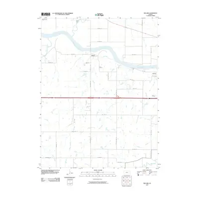
2009 Map of Willard
USGS Topo · Published 2009About this map
The Kansas River cuts a wide, meandering path through this portion of Shawnee County, serving as the primary geographical anchor for the rural communities of Willard and Valencia. This 2009 survey reveals a landscape defined by its riparian geometry, where several significant tributaries such as Mill Creek, Cross Creek, and Post Creek converge toward the main river valley. The settlement pattern follows the high ground and section lines, with the small town of Willard situated on the north bank, while the site of Valencia lies to the southeast.
Find a feature on this map
37 named features on this map. Tap any name to fly to it.
Don’t see what you’re looking for? This feature index may not catch every label — zoom into the map to look around manually.
Map Details
Editions of this 2009 Willard Map
This is the sole edition of this map. No revisions or reprints were ever made.
Other maps of this area

1885 · Eskridge
USGS Topo · 1:125,000

1889 · Burlingame
USGS Topo · 1:125,000

1889 · Wamego
USGS Topo · 1:125,000

1889 · Eskridge
USGS Topo · 1:125,000

1889 · Topeka
USGS Topo · 1:125,000

1894 · Eskridge
USGS Topo · 1:125,000

1894 · Burlingame
USGS Topo · 1:125,000

1894 · Topeka
USGS Topo · 1:125,000

1894 · Wamego
USGS Topo · 1:125,000

1947 · Lawrence
USGS Topo · 1:250,000