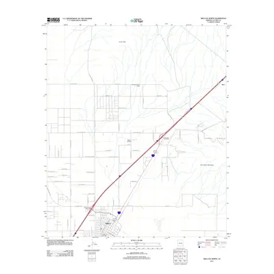
2011 Map of Willcox North
USGS Topo · Published 2011About this map
Willcox serves as the primary hub of this high-desert landscape in Cochise County, anchoring a network of ranching roads and rail infrastructure. The topography is defined by prominent rises like the Circle I Hills and Spike E Hills, while the drainage of Campomocho Draw cuts through the northern flats. To the southeast, the terrain begins its ascent into the Dos Cabezas Mountains, a landmark for generations of travelers in the Sulphur Springs Valley. Transport is a central theme, with the diagonal corridor of the RR 1 railroad and the modern East Willcox Interchange facilitating movement through the region. Named ranch roads like Porters Ranch Rd and Page Ranch Rd suggest the long-standing agricultural and land-use patterns that have shaped this portion of Arizona. The small settlement of Raso marks the northeastern extent of the survey, sitting along the primary rail line.
Find a feature on this map
61 named features on this map. Tap any name to fly to it.
Don’t see what you’re looking for? This feature index may not catch every label — zoom into the map to look around manually.
Map Details
Editions of this 2011 Willcox North Map
This is the sole edition of this map. No revisions or reprints were ever made.
Other maps of this area

1922 · Willcox
USGS Topo · 1:125,000

1943 · Dos Cabezas
USGS Topo · 1:62,500

1943 · Willcox
USGS Topo · 1:62,500

1943 · Cochise
USGS Topo · 1:62,500

1944 · Fisher Hills
USGS Topo · 1:62,500

1954 · Silver City
USGS Topo · 1:250,000

1957 · Dos Cabezas
USGS Topo · 1:62,500

1957 · Luzena
USGS Topo · 1:62,500

1958 · Silver City
USGS Topo · 1:250,000

1958 · Willcox
USGS Topo · 1:62,500