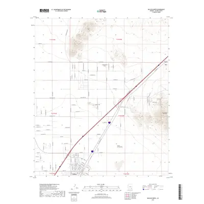
2018 Map of Willcox North
USGS Topo · Published 2018About this map
Willcox serves as the focal point for this survey of the southern Arizona landscape, where the northern reaches of the city meet the vast Sulphur Springs Valley. The terrain is defined by the sharp rise of the Dos Cabezas Mountains to the east and the isolated heights of the Circle Hills and Spike E Hills to the north. A critical transportation corridor passes through Railroad Pass, carrying the Southern Pacific tracks and regional roadways toward the small settlement at Raso. This gap in the mountains has historically dictated the movement of goods and people across the high desert, connecting the basin to the eastern territory. The map reveals a complex network of ranch and access roads, including N Korstens Ranch Rd and N Willow Springs Rd, which trace the drainage patterns of Campomocho Draw and support the agricultural and pastoral activities of Cochise County.
Find a feature on this map
103 named features on this map. Tap any name to fly to it.
Don’t see what you’re looking for? This feature index may not catch every label — zoom into the map to look around manually.
Map Details
Editions of this 2018 Willcox North Map
This is the sole edition of this map. No revisions or reprints were ever made.
Other maps of this area

1922 · Willcox
USGS Topo · 1:125,000

1943 · Dos Cabezas
USGS Topo · 1:62,500

1943 · Willcox
USGS Topo · 1:62,500

1943 · Cochise
USGS Topo · 1:62,500

1944 · Fisher Hills
USGS Topo · 1:62,500

1954 · Silver City
USGS Topo · 1:250,000

1957 · Dos Cabezas
USGS Topo · 1:62,500

1957 · Luzena
USGS Topo · 1:62,500

1958 · Silver City
USGS Topo · 1:250,000

1958 · Willcox
USGS Topo · 1:62,500