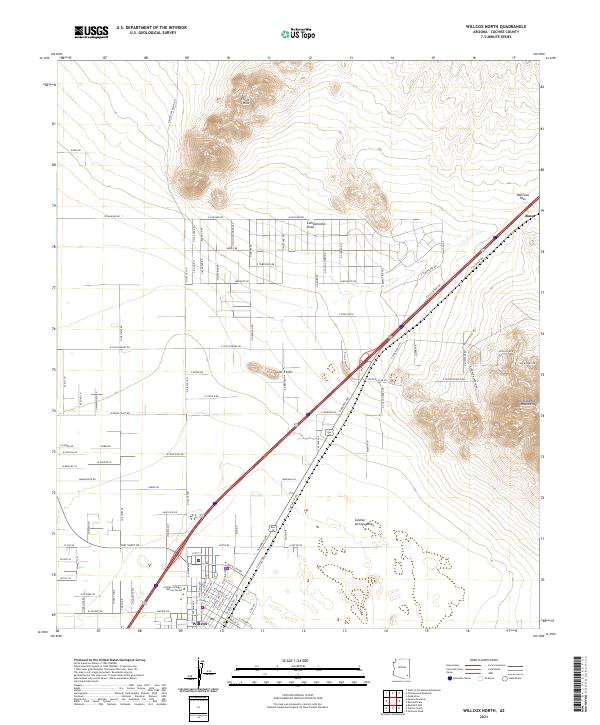
2021 Map of Willcox North
USGS Topo · Published 2021About this map
The Sulphur Springs Valley provides a wide alluvial floor for this Cochise County landscape, where the northern outskirts of Willcox meet the foothills of the Dos Cabezas Mountains. The geography is defined by the critical transit corridor through Railroad Pass, a natural gap that has long facilitated movement across the high desert. Settlement patterns here are characterized by a grid of ranch and residential roads such as W Saguaro Rd and N Korstens Ranch Rd, extending toward the isolated rises of the Circle I Hills and Spike E Hills. Infrastructure for the local community is anchored by the Cochise College - Willcox Center, while the ephemeral Campomocho Draw drains the basin toward the south. Near the northeastern corner of the map, the small settlement of Raso marks a point along the railroad line near the divide.
Find a feature on this map
109 named features on this map. Tap any name to fly to it.
Don’t see what you’re looking for? This feature index may not catch every label — zoom into the map to look around manually.
Map Details
Editions of this 2021 Willcox North Map
This is the sole edition of this map. No revisions or reprints were ever made.
Other maps of this area

1922 · Willcox
USGS Topo · 1:125,000

1943 · Dos Cabezas
USGS Topo · 1:62,500

1943 · Willcox
USGS Topo · 1:62,500

1943 · Cochise
USGS Topo · 1:62,500

1944 · Fisher Hills
USGS Topo · 1:62,500

1954 · Silver City
USGS Topo · 1:250,000

1957 · Dos Cabezas
USGS Topo · 1:62,500

1957 · Luzena
USGS Topo · 1:62,500

1958 · Silver City
USGS Topo · 1:250,000

1958 · Willcox
USGS Topo · 1:62,500