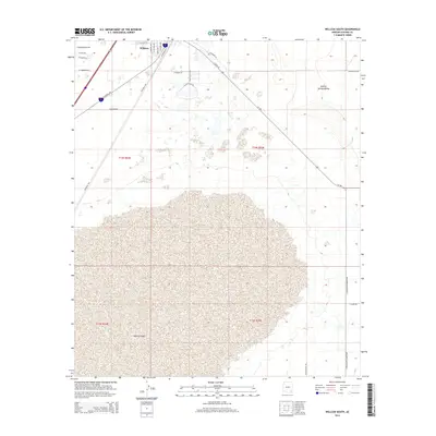
2014 Map of Willcox South
USGS Topo · Published 2014About this map
Willcox serves as the primary hub at the northern edge of this desert landscape, situated within the expansive Sulphur Springs Valley. The town's layout is defined by its historic connection to transportation, with Railroad Ave running parallel to the tracks and streets named for local and regional identity, such as S Rex Allen Jr Dr and S Cochise Ave. South of the residential and commercial blocks, the terrain shifts dramatically into the vast, arid expanse of the Willcox Playa. This dry lake bed dominates the southern half of the sheet, illustrating the internal drainage patterns of the high desert. To the east, the agricultural character of the region emerges along S Kansas Settlement Rd, where the grid of desert roads meets the open flats of the valley floor.
Find a feature on this map
30 named features on this map. Tap any name to fly to it.
Don’t see what you’re looking for? This feature index may not catch every label — zoom into the map to look around manually.
Map Details
Editions of this 2014 Willcox South Map
This is the sole edition of this map. No revisions or reprints were ever made.
Other maps of this area

1922 · Willcox
USGS Topo · 1:125,000

1943 · Dos Cabezas
USGS Topo · 1:62,500

1943 · Willcox
USGS Topo · 1:62,500

1943 · Cochise
USGS Topo · 1:62,500

1944 · Fisher Hills
USGS Topo · 1:62,500

1954 · Silver City
USGS Topo · 1:250,000

1957 · Dos Cabezas
USGS Topo · 1:62,500

1957 · Luzena
USGS Topo · 1:62,500

1958 · Silver City
USGS Topo · 1:250,000

1958 · Willcox
USGS Topo · 1:62,500