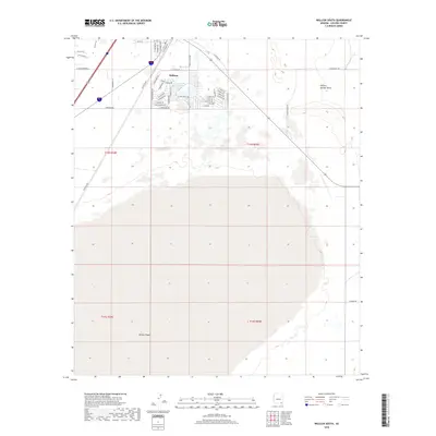
2018 Map of Willcox South
USGS Topo · Published 2018About this map
The southern portion of Willcox is defined by the transition from organized residential streets to the expansive, dry landscape of the Willcox Playa. This 2018 survey reveals the town's expansion southward into the Sulphur Springs Valley, where modern developments like E Lake Circle Dr meet the prehistoric lakebed. The transportation network reflects the area's heritage, with Railroad Ave tracing the historical rail corridor and roads like S Rex Allen Jr Dr and Geronimo Dr honoring local cultural figures. The geometric grid of townships, including t14s r25e and t15s r24e, provides a framework for the rural outskirts where S Newhouse Ln and S Finley Rd reach toward the playa's edge.
Find a feature on this map
48 named features on this map. Tap any name to fly to it.
Don’t see what you’re looking for? This feature index may not catch every label — zoom into the map to look around manually.
Map Details
Editions of this 2018 Willcox South Map
This is the sole edition of this map. No revisions or reprints were ever made.
Other maps of this area

1922 · Willcox
USGS Topo · 1:125,000

1943 · Dos Cabezas
USGS Topo · 1:62,500

1943 · Willcox
USGS Topo · 1:62,500

1943 · Cochise
USGS Topo · 1:62,500

1944 · Fisher Hills
USGS Topo · 1:62,500

1954 · Silver City
USGS Topo · 1:250,000

1957 · Dos Cabezas
USGS Topo · 1:62,500

1957 · Luzena
USGS Topo · 1:62,500

1958 · Silver City
USGS Topo · 1:250,000

1958 · Willcox
USGS Topo · 1:62,500