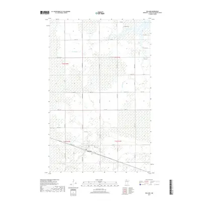
2019 Map of Williams
USGS Topo · Published 2019About this map
Williams serves as the primary hub for this portion of Lake of the Woods County, situated near the intersection of Co Rd 97 and the tracks along Railroad St NW. The landscape is dominated by complex wetland drainage systems, notably the W Br Zippel Cr and S Br Zippel Cr, which flow northward toward the expanse of Zippel Bay. This survey captures the rural infrastructure of the region, featuring significant local landmarks like Pine Hill Cem just east of the main settlement and Hillside Cem further north. The grid of roads, including Wilderness Ave and Co Hwy 12, provides clear evidence of the township divisions and property boundaries that have shaped this northern Minnesota terrain for generations.
Find a feature on this map
45 named features on this map. Tap any name to fly to it.
Don’t see what you’re looking for? This feature index may not catch every label — zoom into the map to look around manually.
Map Details
Editions of this 2019 Williams Map
This is the sole edition of this map. No revisions or reprints were ever made.
Other maps of this area

1918 · Winterroad
USGS Topo · 1:62,500

1918 · Roosevelt
USGS Topo · 1:62,500

1918 · Williams
USGS Topo · 1:62,500

1919 · Peppermint Creek
USGS Topo · 1:62,500

1943 · Peppermint Creek
USGS Topo · 1:62,500

1943 · Roosevelt
USGS Topo · 1:62,500

1954 · Roseau
USGS Topo · 1:250,000

1957 · Roseau
USGS Topo · 1:250,000

1958 · Roseau
USGS Topo · 1:250,000

1967 · Williams
USGS Topo · 1:24,000