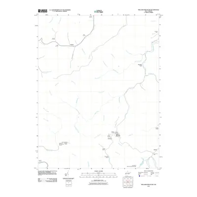
2011 Map of Williams Mountain
USGS Topo · Published 2011About this map
Williams Mountain and the surrounding coal country are defined by a complex network of hollows and creek branches that dictated the settlement patterns of this West Virginia landscape. Small communities like Prenter and Andrew are positioned along the primary watercourses, while numerous family cemeteries including Bias, Harless, and Miller dot the hillsides, providing essential touchpoints for genealogical research. The map illustrates the industrial footprint of the early 21st century through features like the Lotts Branch Slurry Impoundment Dam and the Road Fork Dam. Civil and community infrastructure is marked by the presence of several mail hubs, such as the Seth Post Office and the Williams Mountain Post Office, while the Williams Hill Lookout Tower stands as a prominent high-point landmark overlooking Ruffys Fork and Little Laurel Creek.
Find a feature on this map
59 named features on this map. Tap any name to fly to it.
Don’t see what you’re looking for? This feature index may not catch every label — zoom into the map to look around manually.
Map Details
Editions of this 2011 Williams Mountain Map
This is the sole edition of this map. No revisions or reprints were ever made.
Other maps of this area

1891 · Oceana
USGS Topo · 1:125,000

1893 · Oceana
USGS Topo · 1:125,000

1898 · Oceana
USGS Topo · 1:125,000

1899 · Charleston
USGS Topo · 1:125,000

1909 · Peytona
USGS Topo · 1:48,000

1910 · Bald Knob
USGS Topo · 1:48,000

1911 · Peytona
USGS Topo · 1:62,500

1911 · Madison
USGS Topo · 1:62,500

1912 · Bald Knob
USGS Topo · 1:62,500

1913 · Logan
USGS Topo · 1:62,500