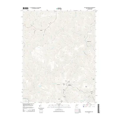
2014 Map of Williams Mountain
USGS Topo · Published 2014About this map
The ridge of Williams Mountain dominates this part of Boone County, rising between the deep-cut valleys of Drawdy Cr and Laurel Creek. This high-altitude landscape is characterized by its legacy of resource extraction, evidenced by the Chesterfield Mine Siltation Pond and the Big Mountain Slurry Pond nestled in the hollows. Small mountain settlements like Andrew and Prenter anchor the local road network, while the Williams Hill Lookout Tower stands as a sentinel over the surrounding timber and watersheds. The area is dotted with family-named cemeteries, including Jarrells Cem, Bias Cem, and Hartless Cem, which provide essential touchpoints for genealogists researching the families who settled these narrow drainages. Numerous forks and branches, such as Sandlick Cr and Honeycamp Fork, illustrate the complex drainage patterns that shaped the region's early transportation routes.
Find a feature on this map
68 named features on this map. Tap any name to fly to it.
Don’t see what you’re looking for? This feature index may not catch every label — zoom into the map to look around manually.
Map Details
Editions of this 2014 Williams Mountain Map
This is the sole edition of this map. No revisions or reprints were ever made.
Other maps of this area

1891 · Oceana
USGS Topo · 1:125,000

1893 · Oceana
USGS Topo · 1:125,000

1898 · Oceana
USGS Topo · 1:125,000

1899 · Charleston
USGS Topo · 1:125,000

1909 · Peytona
USGS Topo · 1:48,000

1910 · Bald Knob
USGS Topo · 1:48,000

1911 · Peytona
USGS Topo · 1:62,500

1911 · Madison
USGS Topo · 1:62,500

1912 · Bald Knob
USGS Topo · 1:62,500

1913 · Logan
USGS Topo · 1:62,500