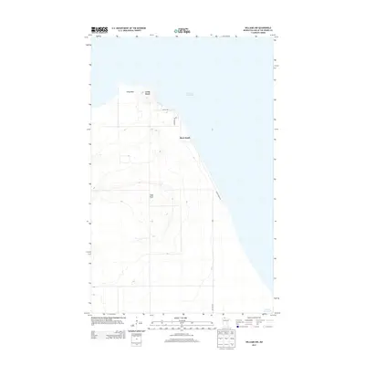
2013 Map of Williams NW
USGS Topo · Published 2013About this map
Birch Beach sits along the southwestern shoreline of Lake of the Woods, serving as a focal point for this coastal Minnesota landscape. The area is characterized by low-lying elevations near the water, rising slightly inland toward the Prosper Lookout Tower. This vantage point provides a clear view of the surrounding woods and the prominent peninsula of Long Point to the north. Local transportation is defined by a modest grid of coastal roads, including Sandy Shores Dr and Lakeshore Dr NW, which cater to the seasonal and permanent residences that hug the lakeshore. The geography here is fundamentally shaped by the water, with the shoreline's curve dictating the layout of Birch Beach and its connectivity to the larger wilderness of Lake of the Woods County.
Find a feature on this map
8 named features on this map. Tap any name to fly to it.
Don’t see what you’re looking for? This feature index may not catch every label — zoom into the map to look around manually.
Map Details
Editions of this 2013 Williams NW Map
This is the sole edition of this map. No revisions or reprints were ever made.
Other maps of this area

1918 · Buffalo Bay
USGS Topo · 1:62,500

1918 · Roosevelt
USGS Topo · 1:62,500

1918 · Williams
USGS Topo · 1:62,500

1943 · Roosevelt
USGS Topo · 1:62,500

1954 · Roseau
USGS Topo · 1:250,000

1957 · Roseau
USGS Topo · 1:250,000

1958 · Roseau
USGS Topo · 1:250,000

1963 · Kenora
USGS Topo · 1:250,000

1967 · Williams
USGS Topo · 1:24,000
1967 · Roosevelt
USGS Topo · 1:24,000