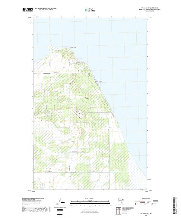
2022 Map of Williams NW
USGS Topo · Published 2022About this map
Birch Beach sits along the western shoreline of Lake of the Woods, serving as a primary point of human activity in this heavily marshalled landscape. The geography is defined by extensive wetlands that stretch inland, intersected by a grid of rural roads such as Co St Aid Hwy 2 and Hunter Ridge Rd NW. To the north, the prominent peninsula of Long Point reaches into the lake, creating a distinct coastal landmark. This 2022 survey illustrates a modern transition where recreational lakefront properties and residential corridors like Sandy Shores Dr meet the managed wilderness of the interior. The presence of a Logging Trl and various section-line roads indicates a land still utilized for its natural resources and seasonal access, while clusters of development like Resort Ln NW emphasize the area's contemporary role as a northern Minnesota retreat.
Find a feature on this map
30 named features on this map. Tap any name to fly to it.
Don’t see what you’re looking for? This feature index may not catch every label — zoom into the map to look around manually.
Map Details
Editions of this 2022 Williams NW Map
This is the sole edition of this map. No revisions or reprints were ever made.
Other maps of this area

1918 · Buffalo Bay
USGS Topo · 1:62,500

1918 · Roosevelt
USGS Topo · 1:62,500

1918 · Williams
USGS Topo · 1:62,500

1943 · Roosevelt
USGS Topo · 1:62,500

1954 · Roseau
USGS Topo · 1:250,000

1957 · Roseau
USGS Topo · 1:250,000

1958 · Roseau
USGS Topo · 1:250,000

1963 · Kenora
USGS Topo · 1:250,000

1967 · Williams
USGS Topo · 1:24,000
1967 · Roosevelt
USGS Topo · 1:24,000