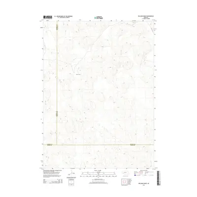
2014 Map of Williams Ranch
USGS Topo · Published 2014About this map
Williams Ranch occupies a central position within this part of the Nebraska Sandhills, a landscape defined by the intricate contouring of wind-formed hills. This 2014 survey documents a quiet interior section of Arthur County, where the settlement pattern is sparse and heavily reliant on vast ranching tracts. The map reveals the precise intersection of three counties, showing where the boundaries for Garden, Keith, and Arthur counties meet at a legal corner. Apart from the namesake ranch, the only significant infrastructure is W Wilson Rd in the northeast, highlighting the isolation and scale of these western Nebraska operations.
Find a feature on this map
5 named features on this map. Tap any name to fly to it.
Don’t see what you’re looking for? This feature index may not catch every label — zoom into the map to look around manually.
Map Details
Editions of this 2014 Williams Ranch Map
This is the sole edition of this map. No revisions or reprints were ever made.
Other maps of this area

1897 · Ogallala
USGS Topo · 1:125,000

1900 · Chappell
USGS Topo · 1:125,000

1900 · Ogallala
USGS Topo · 1:125,000

1949 · Rackett
USGS Topo · 1:62,500

1950 · Velma
USGS Topo · 1:62,500

1951 · Rackett
USGS Topo · 1:62,500

1954 · Scottsbluff
USGS Topo · 1:250,000

1954 · North Platte
USGS Topo · 1:250,000

1956 · North Platte
USGS Topo · 1:250,000

1957 · North Platte
USGS Topo · 1:250,000