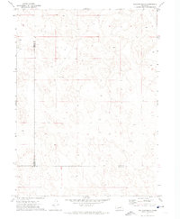
1971 Map of Williams Ranch
USGS Topo · Published 1974About this map
The intersection of Garden Co Arthur Co, Keith Co, and Arthur Co Keith Co defines this sparsely settled region of the Nebraska Sandhills. This survey, based on aerial photography from 1969 and field checked in 1971, illustrates the isolated nature of cattle ranching in the High Plains. The landscape is dominated by complex dune formations and depressions, where small family holdings like the Williams Ranch and Orr Ranch are the primary landmarks. Scattered throughout the quadrangle are numerous Well symbols, highlighting the critical importance of groundwater access for livestock in this semi-arid environment. Fine dashed lines delineate fence and field boundaries, providing a detailed record of land use and property management in a territory where traditional roads are few and often unimproved.
Find a feature on this map
6 named features on this map. Tap any name to fly to it.
Don’t see what you’re looking for? This feature index may not catch every label — zoom into the map to look around manually.
Map Details
Editions of this 1971 Williams Ranch Map
This is the sole edition of this map. No revisions or reprints were ever made.
Other maps of this area

1897 · Ogallala
USGS Topo · 1:125,000

1900 · Chappell
USGS Topo · 1:125,000

1900 · Ogallala
USGS Topo · 1:125,000

1949 · Rackett
USGS Topo · 1:62,500

1950 · Velma
USGS Topo · 1:62,500

1951 · Rackett
USGS Topo · 1:62,500

1954 · Scottsbluff
USGS Topo · 1:250,000

1954 · North Platte
USGS Topo · 1:250,000

1956 · North Platte
USGS Topo · 1:250,000

1957 · North Platte
USGS Topo · 1:250,000