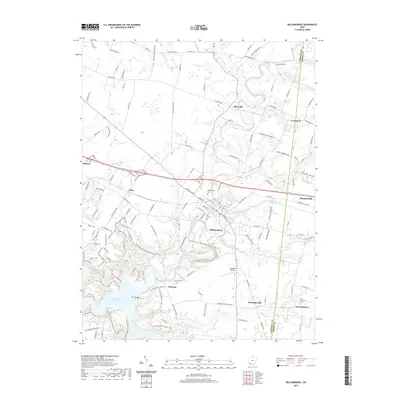
2019 Map of Williamsburg
USGS Topo · Published 2019About this map
Williamsburg serves as the central hub of this Clermont County landscape, where the East Fork Little Miami River winds through a valley now dominated by the waters of William H Harsha Lake. The map illustrates a transition from the structured street grid of the village, anchored by the Williamsburg Cem, to the rural hamlets of Concord and Hennings Mill further south. Modern transportation corridors like Old State Rte 32 parallel older routes, while landmarks like the Old Boston Airport and the residential clusters near Lake O' the Woods show the evolution of local land use. In the western reaches, smaller settlements like Afton and the edge of Batavia are connected by a network of creeks including Slabcamp Run and Kain Run, while the eastern border meets Brown County at Mount Orab.
Find a feature on this map
134 named features on this map. Tap any name to fly to it.
Don’t see what you’re looking for? This feature index may not catch every label — zoom into the map to look around manually.
Map Details
Editions of this 2019 Williamsburg Map
This is the sole edition of this map. No revisions or reprints were ever made.
Other maps of this area

1914 · Batavia
USGS Topo · 1:48,000

1916 · Batavia
USGS Topo · 1:62,500

1917 · Sardinia
USGS Topo · 1:62,500

1928 · Higginsport
USGS Topo · 1:48,000

1931 · Felicity
USGS Topo · 1:62,500

1931 · Higginsport
USGS Topo · 1:62,500

1944 · Sardinia
USGS Topo · 1:62,500

1947 · Columbus
USGS Topo · 1:250,000

1953 · Laurel
USGS Topo · 1:24,000

1953 · Bethel
USGS Topo · 1:24,000