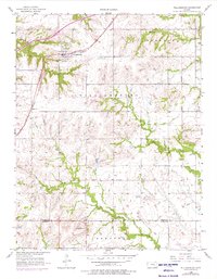
1956 Map of Williamsburg
USGS Topo · Published 1976About this map
Williamsburg serves as the primary hub of this eastern Kansas landscape, situated along the Atchison Topeka and Santa Fe railroad line. The settlement pattern follows the rail corridor and established roadways, with Silkville located to the southwest. A significant historical demarcation, the Old Indian Boundary, cuts across the central and southern portions of the map, tracing an earlier era of land division and displacement.
Find a feature on this map
18 named features on this map. Tap any name to fly to it.
Don’t see what you’re looking for? This feature index may not catch every label — zoom into the map to look around manually.
Map Details
Editions of this 1956 Williamsburg Map
3 editions found

Other maps of this area

1885 · Burlington
USGS Topo · 1:125,000

1885 · Garnett
USGS Topo · 1:125,000

1885 · Lawrence
USGS Topo · 1:125,000

1889 · Burlingame
USGS Topo · 1:125,000

1889 · Lawrence
USGS Topo · 1:125,000

1894 · Garnett
USGS Topo · 1:125,000

1894 · Burlingame
USGS Topo · 1:125,000

1894 · Burlington
USGS Topo · 1:125,000

1947 · Lawrence
USGS Topo · 1:250,000

1950 · Lawrence
USGS Topo · 1:250,000