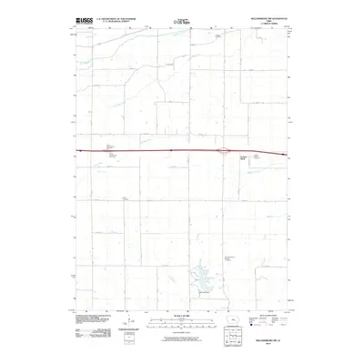
2010 Map of Williamsburg NW
USGS Topo · Published 2010About this map
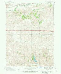
Lake Iowa and the Iowa Lake Dam anchor the southern portion of this Iowa County landscape, surrounded by a network of drainage ways including Devils Run, Pig Creek, and Hog Run. This agrarian region, captured in the early 21st century, is defined by its rectilinear road grid where long stretches of A Diagonal cut across section lines. The settlement at Gonoa Bluff is a key landmark in the eastern section, situated near Old Mans Creek and the Genoa Bluffs Cemetery. Genealogists will find several distinct burial sites across the township, including Smith Cemetery, the Ladora Cemetery in the north, and the Zion Reformed Church Cemetery further south. Modern transportation is represented by the major east-west corridor passing between the Victor West Bound Rest Area and its eastbound counterpart, contrasting with the slower pace of the surrounding creeks and fields.
Find a feature on this map
35 named features on this map. Tap any name to fly to it.
Don’t see what you’re looking for? This feature index may not catch every label — zoom into the map to look around manually.
Map Details
Editions of this 2010 Williamsburg NW Map
This is the sole edition of this map. No revisions or reprints were ever made.
Other maps of this area

1954 · Des Moines
USGS Topo · 1:250,000

1956 · Des Moines
USGS Topo · 1:250,000

1957 · Des Moines
USGS Topo · 1:250,000

1965 · Ladora
USGS Topo · 1:24,000
1965 · Marengo
USGS Topo · 1:24,000

1968 · Deep River
USGS Topo · 1:24,000
1968 · North English
USGS Topo · 1:24,000
1968 · Williamsburg
USGS Topo · 1:24,000

1968 · Victor
USGS Topo · 1:24,000
1968 · Williamsburg NW
USGS Topo · 1:24,000