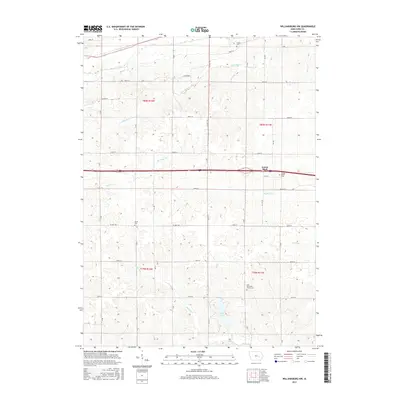
2015 Map of Williamsburg NW
USGS Topo · Published 2015About this map
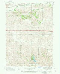
Genoa Bluff and its surrounding countryside represent a classic slice of rural Iowa County, defined by a rolling landscape carved by numerous named waterways. The drainage pattern here is particularly dense, with Old Mans Cr, Big Bear Creek, and Devils Run winding through the townships, while Lake Iowa serves as a prominent local landmark. For genealogists and local historians, the sheet preserves the locations of several burial grounds, including the Zion Reformed Church Cem and the Genoa Bluffs Cem. The map illustrates a strictly organized grid of rural roads like 200th St and CC Ave that cut across the natural topography, showing how the midwestern section-line system interacts with the uneven terrain of the creek valleys such as Hog Run and Pig Cr.
Find a feature on this map
31 named features on this map. Tap any name to fly to it.
Don’t see what you’re looking for? This feature index may not catch every label — zoom into the map to look around manually.
Map Details
Editions of this 2015 Williamsburg NW Map
This is the sole edition of this map. No revisions or reprints were ever made.
Other maps of this area

1954 · Des Moines
USGS Topo · 1:250,000

1956 · Des Moines
USGS Topo · 1:250,000

1957 · Des Moines
USGS Topo · 1:250,000

1965 · Ladora
USGS Topo · 1:24,000
1965 · Marengo
USGS Topo · 1:24,000

1968 · Deep River
USGS Topo · 1:24,000
1968 · North English
USGS Topo · 1:24,000
1968 · Williamsburg
USGS Topo · 1:24,000

1968 · Victor
USGS Topo · 1:24,000
1968 · Williamsburg NW
USGS Topo · 1:24,000