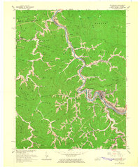
1964 Map of Williamson
USGS Topo · Published 1965About this map
The Tug Fork and Tug River wind through a landscape defined by the coal and rail industries of Central Appalachia. This mid-1960s survey captures the bustling activity in Williamson, West Virginia, and its surrounding industrial satellites. The Norfolk and Western railroad corridor follows the riverbanks, serving a dense network of mountain communities including Nolan, Borderland, and Chattaroy. The map illustrates the intensive development along the narrow valley floors, where the Corporate Boundary of the city expands into West Williamson and East Williamson.
Find a feature on this map
71 named features on this map. Tap any name to fly to it.
Don’t see what you’re looking for? This feature index may not catch every label — zoom into the map to look around manually.
Map Details
Editions of this 1964 Williamson Map
4 editions found
Other maps of this area

1887 · Warfield
USGS Topo · 1:125,000

1891 · Warfield
USGS Topo · 1:125,000

1909 · Matewan
USGS Topo · 1:48,000

1910 · Holden
USGS Topo · 1:48,000

1910 · Naugatuck
USGS Topo · 1:48,000

1912 · Naugatuck
USGS Topo · 1:62,500

1912 · Holden
USGS Topo · 1:62,500

1915 · Williamson
USGS Topo · 1:48,000

1915 · Naugatuck
USGS Topo · 1:48,000

1915 · Matewan
USGS Topo · 1:48,000