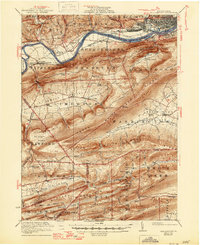
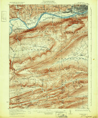
1923 Map of Williamsport
USGS Topo · Published 1946About this map
Williamsport and its industrial satellites dominate the northern edge of this 1920s landscape, positioned along the sweeping curves of the West Branch Susquehanna River. The map illustrates a dense concentration of infrastructure near the river, including the Pennsylvania railroad lines serving South Williamsport, Duboistown, and Newberry. This urban development sharply contrasts with the series of high ridges to the south, such as Bald Eagle Mountain and Nittany Mountain, which dictate the placement of rural settlements and mountain gaps.
Find a feature on this map
88 named features on this map. Tap any name to fly to it.
Don’t see what you’re looking for? This feature index may not catch every label — zoom into the map to look around manually.
Map Details
Editions of this 1923 Williamsport Map
6 editions found
Other maps of this area

1893 · Sunbury
USGS Topo · 1:62,500

1921 · Williamsport
USGS Topo · 1:48,000

1921 · Trout Run
USGS Topo · 1:62,500

1921 · Lock Haven
USGS Topo · 1:62,500

1923 · Lock Haven
USGS Topo · 1:62,500

1923 · Trout Run
USGS Topo · 1:62,500

1923 · Williamsport
USGS Topo · 1:62,500

1924 · Milton
USGS Topo · 1:62,500

1930 · Warrensville
USGS Topo · 1:62,500

1934 · Warrensville
USGS Topo · 1:62,500
Featured Places
- Williamsport, PA
- White Deer Township, PA
- Garden View, Old Lycoming Township
- Duboistown, PA
- Bastress Township, PA