
1962 Map of Williamsport
USGS Topo · Published 1966About this map
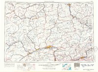
The West Branch Susquehanna River carves a deep path through north-central Pennsylvania, serving as the central artery for industry and transport between Lock Haven and Williamsport. During the early 1960s, the region's economy relied heavily on the corridor formed by the Pennsylvania Railroad and the Reading Railroad, which skirt the northern edges of Bald Eagle Mountain. The map illustrates the sharp transition from the industrial river towns to the expansive woodlands of the Allegheny Plateau and the Endless Mountains.
Find a feature on this map
78 named features on this map. Tap any name to fly to it.
Don’t see what you’re looking for? This feature index may not catch every label — zoom into the map to look around manually.
Map Details
Editions of this 1962 Williamsport Map
5 editions found
Other maps of this area

1889 · Catawissa
USGS Topo · 1:62,500

1889 · Hazleton
USGS Topo · 1:62,500

1891 · Wilkesbarre
USGS Topo · 1:62,500

1891 · Hazleton
USGS Topo · 1:62,500

1891 · Harveys Lake
USGS Topo · 1:62,500

1892 · Catawissa
USGS Topo · 1:62,500

1892 · Shamokin
USGS Topo · 1:62,500

1892 · Mahanoy
USGS Topo · 1:62,500

1893 · Hazleton
USGS Topo · 1:62,500

1893 · Sunbury
USGS Topo · 1:62,500