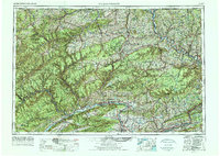
1962 Map of Williamsport
USGS Topo · Published 1988About this map
Williamsport serves as the focal point of this regional study, situated along the curve of the West Branch Susquehanna River and framed by the rising heights of Bald Eagle Mountain. The mid-century landscape is defined by its industrial transit corridors, notably where the Pennsylvania RR and Reading RR navigate the river valleys and mountain gaps to connect centers like Jersey Shore, Milton, and Bloomsburg.
Find a feature on this map
88 named features on this map. Tap any name to fly to it.
Don’t see what you’re looking for? This feature index may not catch every label — zoom into the map to look around manually.
Map Details
Editions of this 1962 Williamsport Map
5 editions found

Other maps of this area

1889 · Catawissa
USGS Topo · 1:62,500

1889 · Hazleton
USGS Topo · 1:62,500

1891 · Wilkesbarre
USGS Topo · 1:62,500

1891 · Hazleton
USGS Topo · 1:62,500

1891 · Harveys Lake
USGS Topo · 1:62,500

1892 · Catawissa
USGS Topo · 1:62,500

1892 · Shamokin
USGS Topo · 1:62,500

1892 · Mahanoy
USGS Topo · 1:62,500

1893 · Hazleton
USGS Topo · 1:62,500

1893 · Sunbury
USGS Topo · 1:62,500