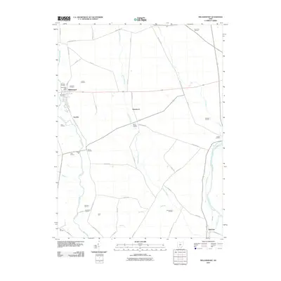
2010 Map of Williamsport
USGS Topo · Published 2010About this map
The Scioto River valley defines the eastern edge of this landscape, where the remnants of the Erie Canal parallel the river near the settlement of Yellowbud. Moving westward, the terrain is shaped by the drainage networks of Deer Creek, Yellowbud Creek, and Wolf Run, supporting a dense collection of family farms and rural cemeteries. The village of Williamsport serves as a primary hub, containing the Williamsport Post Office and multiple burial grounds including Christian Cemetery and Springlawn Cemetery.
Find a feature on this map
55 named features on this map. Tap any name to fly to it.
Don’t see what you’re looking for? This feature index may not catch every label — zoom into the map to look around manually.
Map Details
Editions of this 2010 Williamsport Map
This is the sole edition of this map. No revisions or reprints were ever made.
Other maps of this area

1906 · Chillicothe
USGS Topo · 1:62,500

1908 · Chillicothe
USGS Topo · 1:62,500

1911 · Era
USGS Topo · 1:62,500

1912 · Roxabell
USGS Topo · 1:62,500

1913 · Era
USGS Topo · 1:62,500

1914 · Roxabell
USGS Topo · 1:62,500

1914 · Circleville
USGS Topo · 1:62,500

1943 · Era
USGS Topo · 1:62,500

1943 · Circleville
USGS Topo · 1:62,500

1944 · Roxabell
USGS Topo · 1:62,500