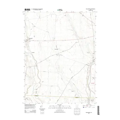
2013 Map of Williamsport
USGS Topo · Published 2013About this map
Williamsport serves as a primary hub for this fertile agricultural corridor where the Deer Creek valley transitions toward the Pickaway Plains. The landscape is densely marked by the legacy of early families, with numerous burial grounds such as Springlawn Cem, Yates Cem, and Hulse Farm Cem scattered across the uplands. The crossing at Pecks Ford and the settlement of Yellowbud reflect the historic importance of the Scioto River waterway on the eastern edge of the survey. Transportation patterns here are defined by long-established routes like Us-22 and Oh-138, which connect smaller communities like Kinderhook and Westfall. This area is characterized by large agricultural holdings, including Rolling H Farm and Azbell Farms, illustrating the enduring farming character of the Pickaway and Ross County borderlands.
Find a feature on this map
71 named features on this map. Tap any name to fly to it.
Don’t see what you’re looking for? This feature index may not catch every label — zoom into the map to look around manually.
Map Details
Editions of this 2013 Williamsport Map
This is the sole edition of this map. No revisions or reprints were ever made.
Other maps of this area

1906 · Chillicothe
USGS Topo · 1:62,500

1908 · Chillicothe
USGS Topo · 1:62,500

1911 · Era
USGS Topo · 1:62,500

1912 · Roxabell
USGS Topo · 1:62,500

1913 · Era
USGS Topo · 1:62,500

1914 · Roxabell
USGS Topo · 1:62,500

1914 · Circleville
USGS Topo · 1:62,500

1943 · Era
USGS Topo · 1:62,500

1943 · Circleville
USGS Topo · 1:62,500

1944 · Roxabell
USGS Topo · 1:62,500