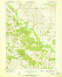
1951 Map of Williamstown
USGS Topo · Published 1951About this map
Williamstown serves as the primary hub of this 1951 survey, situated amidst the winding drainages of the North Fabius River and Middle Fabius River. The landscape is defined by its agrarian distribution, where numerous one-room schoolhouses and small family cemeteries are scattered across the townships of Reddish, Lyon, Dickerson, and La Belle. This distribution highlights a mid-century rural education network, with structures like Walker Sch, Morris Sch, and Turpin Sch serving the local farming population.
Find a feature on this map
27 named features on this map. Tap any name to fly to it.
Don’t see what you’re looking for? This feature index may not catch every label — zoom into the map to look around manually.
Map Details
Editions of this 1951 Williamstown Map
2 editions found
Other maps of this area

1903 · Kahoka
USGS Topo · 1:125,000

1949 · St. Patrick
USGS Topo · 1:24,000

1950 · Saint Patrick
USGS Topo · 1:24,000

1950 · Neeper
USGS Topo · 1:24,000

1950 · Benjamin
USGS Topo · 1:24,000

1950 · Williamstown
USGS Topo · 1:24,000

1950 · Lewistown
USGS Topo · 1:24,000

1950 · Colony
USGS Topo · 1:24,000
1950 · Monticello
USGS Topo · 1:24,000

1950 · La Belle
USGS Topo · 1:24,000