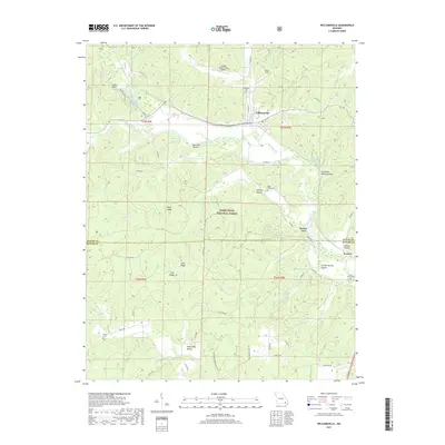
2017 Map of Williamsville
USGS Topo · Published 2017About this map
Williamsville serves as the primary hub in this Ozark foothills landscape, situated just north of a sharp bend in the Black River. This 2017 survey details the complex terrain where the river valleys meet the high ridges of the Mark Twain National Forest, such as Cane Ridge and High Ridge. Settlement is clustered around family-named hollows and historic springs, most notably Markham Spring and Essman Spring. The presence of several rural burial grounds, including Holladay Cem, Shiloh Cem, and Miller Creek Cem, provides significant data for genealogical research. The map also documents modern land use alongside older landmarks, showing the proximity of Faries Field and the Rolling Shoals Farm Airport to the established community at Keeners. The winding routes of State HWY JJ and various forest roads like Pine Cone Rd connect these isolated hollows and landmarks like Keener Cave, illustrating the enduring transportation patterns of Wayne Co and Butler Co.
Find a feature on this map
59 named features on this map. Tap any name to fly to it.
Don’t see what you’re looking for? This feature index may not catch every label — zoom into the map to look around manually.
Map Details
Editions of this 2017 Williamsville Map
This is the sole edition of this map. No revisions or reprints were ever made.
Other maps of this area

1932 · Piedmont
USGS Topo · 1:62,500

1934 · Greenville
USGS Topo · 1:62,500

1934 · Williamsville
USGS Topo · 1:48,000

1935 · Poplar Bluff
USGS Topo · 1:62,500

1935 · Piedmont
USGS Topo · 1:62,500

1939 · Greenville
USGS Topo · 1:62,500

1939 · Poplar Bluff
USGS Topo · 1:62,500

1940 · Williamsville
USGS Topo · 1:62,500

1949 · Rolla
USGS Topo · 1:250,000

1949 · Poplar Bluff
USGS Topo · 1:62,500