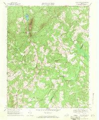
1968 Map of Willis Mountain
USGS Topo · Published 1971About this map
Willis Mountain rises sharply from the Piedmont floor, dominating a landscape defined by the winding course of the Willis River and its numerous tributaries. In the late 1960s, this portion of Buckingham County remained primarily rural, characterized by small crossroads settlements like Curdsville and Sheppards. The presence of a prominent Mine and an Industrial Waste Pond near the northern ridge of the mountain indicates the area's ongoing mineral extraction economy, overseen by the Virginia Division of Mineral Resources.
Find a feature on this map
27 named features on this map. Tap any name to fly to it.
Don’t see what you’re looking for? This feature index may not catch every label — zoom into the map to look around manually.
Map Details
Editions of this 1968 Willis Mountain Map
4 editions found
Other maps of this area

1891 · Palmyra
USGS Topo · 1:125,000

1891 · Farmville
USGS Topo · 1:125,000

1892 · Buckingham
USGS Topo · 1:125,000

1892 · Appomattox
USGS Topo · 1:125,000

1893 · Farmville
USGS Topo · 1:125,000

1895 · Palmyra
USGS Topo · 1:125,000

1897 · Palmyra
USGS Topo · 1:125,000

1947 · Roanoke
USGS Topo · 1:250,000

1950 · Dillwyn
USGS Topo · 1:62,500

1958 · Farmville
USGS Topo · 1:62,500