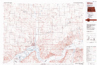
1983 Map of Williston
USGS Topo · Published 1984About this map
Williston stands as the regional hub at the confluence of the Missouri River and the expanding waters of Lake Sakakawea during the early 1980s. This survey illustrates the intricate drainage system of the Missouri Plateau, defined by numerous coulees and sloughs such as Heidemann Coulee, Chinaman Coulee, and Jenny Anderson Slough. The landscape is a mix of agricultural sections and protected conservation zones, including the Little Missouri National Grassland and several state wildlife management areas like Trenton State Wildlife Management Area. Transport infrastructure is dominated by the Burlington Northern railroad and Sloulin International Airport, serving smaller outlying settlements such as Epping, Ray, and Trenton. This era shows the region balanced between its traditional rail-and-river geography and modern industrial development.
Find a feature on this map
54 named features on this map. Tap any name to fly to it.
Don’t see what you’re looking for? This feature index may not catch every label — zoom into the map to look around manually.
Map Details
Editions of this 1983 Williston Map
This is the sole edition of this map. No revisions or reprints were ever made.
Other maps of this area

1909 · Glendive
USGS Topo · 1:250,000

1911 · Ray
USGS Topo · 1:125,000

1946 · Brush Lake
USGS Topo · 1:24,000

1948 · Grenora
USGS Topo · 1:24,000

1948 · Hanks
USGS Topo · 1:24,000

1948 · Brush Lake
USGS Topo · 1:24,000

1948 · Zahl
USGS Topo · 1:24,000

1953 · Williston
USGS Topo · 1:250,000

1953 · Watford City
USGS Topo · 1:250,000

1954 · Glendive
USGS Topo · 1:250,000