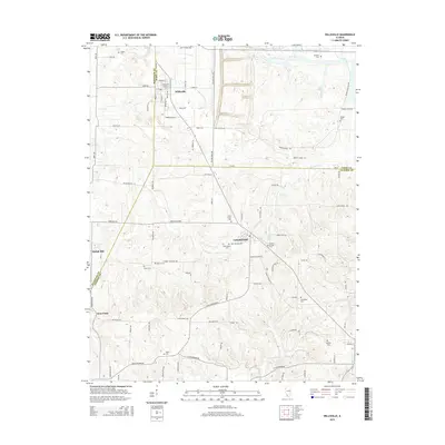
2015 Map of Willisville
USGS Topo · Published 2015About this map
Willisville and Campbell Hill anchor this rural landscape along the borders of Perry, Jackson, and Randolph counties. This 2015 survey reveals a terrain defined by a dense network of family-named cemeteries and small tributaries, including Pipestone Cr and Little Kinkaid Cr. The presence of Saint Joseph Cem, Saint Lukes Cem, and Saint Peters Cem highlights the religious and community centers that have long organized life here. In the southern half of the map, smaller settlements like Shiloh Hill and West Point sit among the headwaters of Cox Cr and Piney Br. The road network, with names like Brick Plant Rd and Mine St, points to the industrial history of the region, while the winding rural routes connect isolated family landmarks such as Cheatham Cem and Modglin Cem.
Find a feature on this map
89 named features on this map. Tap any name to fly to it.
Don’t see what you’re looking for? This feature index may not catch every label — zoom into the map to look around manually.
Map Details
Editions of this 2015 Willisville Map
This is the sole edition of this map. No revisions or reprints were ever made.
Other maps of this area

1910 · Murphysboro
USGS Topo · 1:62,500

1914 · Coulterville
USGS Topo · 1:62,500

1916 · Campbell Hill
USGS Topo · 1:62,500

1917 · Coulterville
USGS Topo · 1:62,500

1918 · Campbell Hill
USGS Topo · 1:62,500

1924 · Pinckneyville
USGS Topo · 1:62,500

1926 · Pinckneyville
USGS Topo · 1:62,500

1938 · Murphysboro
USGS Topo · 1:62,500

1949 · Paducah
USGS Topo · 1:250,000

1950 · Paducah
USGS Topo · 1:250,000