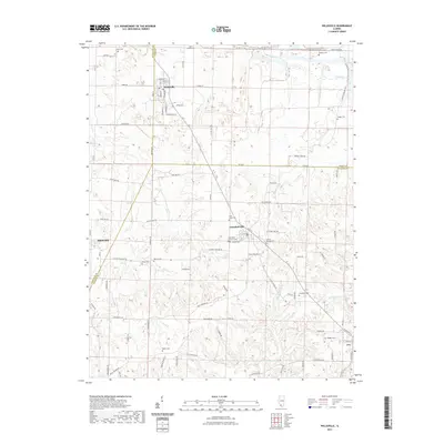
2021 Map of Willisville
USGS Topo · Published 2021About this map
Willisville and Campbell Hill anchor this survey of the Illinois borderlands between Randolph, Perry, and Jackson Counties. The landscape is defined by its deep genealogical roots, visible in the high density of family and community burial grounds like Stoker Cem, Barrow Cem, and Looney Springs Cem. Settlement patterns follow the high ground between creek systems, with Ava situated in the southeast and Shiloh Hill to the west. The drainage network, including Pipestone Cr and Little Kinkaid Cr, influences the rural road layout, where local routes like Brick Plant Rd and Loy School Rd hint at the historical industries and educational hubs that once served these dispersed farming communities. Numerous small cemeteries, such as Saint Peter Lutheran Cem and Cheatham Cem, provide specific points of interest for researchers tracing family ties through this southern Illinois terrain.
Find a feature on this map
91 named features on this map. Tap any name to fly to it.
Don’t see what you’re looking for? This feature index may not catch every label — zoom into the map to look around manually.
Map Details
Editions of this 2021 Willisville Map
This is the sole edition of this map. No revisions or reprints were ever made.
Other maps of this area

1910 · Murphysboro
USGS Topo · 1:62,500

1914 · Coulterville
USGS Topo · 1:62,500

1916 · Campbell Hill
USGS Topo · 1:62,500

1917 · Coulterville
USGS Topo · 1:62,500

1918 · Campbell Hill
USGS Topo · 1:62,500

1924 · Pinckneyville
USGS Topo · 1:62,500

1926 · Pinckneyville
USGS Topo · 1:62,500

1938 · Murphysboro
USGS Topo · 1:62,500

1949 · Paducah
USGS Topo · 1:250,000

1950 · Paducah
USGS Topo · 1:250,000