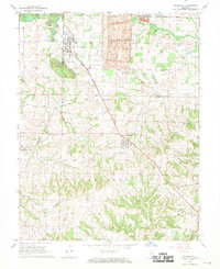
1968 Map of Willisville
USGS Topo · Published 1970About this map
Willisville and Campbell Hill anchor this rural landscape in the late 1960s, a region where the industrial footprint of the Strip Mine contrasts with the surrounding agricultural and creek-cut terrain. The Gulf Mobile and Ohio railroad cuts a diagonal path through the area, linking these small settlements and passing near the Trico High Sch. This era of the landscape is characterized by a dense network of country cemeteries and parish life, with family and community sites like St Joseph Cem, Bradley Cem, and the Blackberry Community Hall serving as local landmarks. The drainage of Pipestone Creek and Cox Creek defines the local topography, while numerous small churches such as St Johns Ch and St Peters Ch reflect the established social fabric of Perry, Randolph, and Jackson counties.
Find a feature on this map
38 named features on this map. Tap any name to fly to it.
Don’t see what you’re looking for? This feature index may not catch every label — zoom into the map to look around manually.
Map Details
Editions of this 1968 Willisville Map
2 editions found
Other maps of this area

1910 · Murphysboro
USGS Topo · 1:62,500

1914 · Coulterville
USGS Topo · 1:62,500

1916 · Campbell Hill
USGS Topo · 1:62,500

1917 · Coulterville
USGS Topo · 1:62,500

1918 · Campbell Hill
USGS Topo · 1:62,500

1924 · Pinckneyville
USGS Topo · 1:62,500

1926 · Pinckneyville
USGS Topo · 1:62,500

1938 · Murphysboro
USGS Topo · 1:62,500

1949 · Paducah
USGS Topo · 1:250,000

1950 · Paducah
USGS Topo · 1:250,000