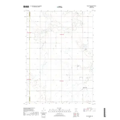
2019 Map of Willow Creek
USGS Topo · Published 2019About this map
The small settlement of Willow Creek serves as a focal point for this rural landscape along the border of Blue Earth and Watonwan counties. In the late 2010s, this area remained defined by its agricultural grid and a series of historic community centers, including Trinity Cem and Ohio Cem. The terrain is drained by several meandering watercourses, most notably Perch Cr and Spring Br Cr, which navigate the low-lying prairie topography. Local genealogy and history are anchored by these sites and the pair of religious landmarks, North Saint Johns Cem and South Saint Johns Cem. Notable for more contemporary aviation interests, the Zarn Airport is situated just north of the principal village, while Porter Lake provides a distinct hydrological feature in the northeast quadrant of the survey.
Find a feature on this map
41 named features on this map. Tap any name to fly to it.
Don’t see what you’re looking for? This feature index may not catch every label — zoom into the map to look around manually.
Map Details
Editions of this 2019 Willow Creek Map
This is the sole edition of this map. No revisions or reprints were ever made.
Other maps of this area

1951 · Mankato West
USGS Topo · 1:62,500

1953 · New Ulm
USGS Topo · 1:250,000

1954 · Fairmont
USGS Topo · 1:250,000

1957 · New Ulm
USGS Topo · 1:250,000

1958 · New Ulm
USGS Topo · 1:250,000

1958 · Fairmont
USGS Topo · 1:250,000

1965 · Madelia
USGS Topo · 1:24,000

1965 · Perth
USGS Topo · 1:24,000

1967 · New Ulm
USGS Topo · 1:250,000

1967 · Truman
USGS Topo · 1:24,000