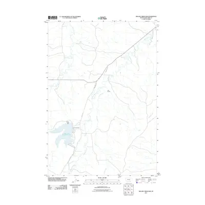
2011 Map of Willow Creek Dam
USGS Topo · Published 2011About this map
Willow Creek Dam and its associated Lodge Grass Storage Reservoir anchor this 2011 survey of the Big Horn County landscape. The map reveals a complex water management system essential to the region's agricultural character, featuring the Lodge Grass Feeder Canal and Lodge Grass Canal Number Two. These man-made improvements cut across a terrain defined by naturally occurring waterways like Rotten Grass Creek and the meandering Lodge Grass Creek.
Find a feature on this map
16 named features on this map. Tap any name to fly to it.
Don’t see what you’re looking for? This feature index may not catch every label — zoom into the map to look around manually.
Map Details
Editions of this 2011 Willow Creek Dam Map
This is the sole edition of this map. No revisions or reprints were ever made.
Other maps of this area

1894 · Rosebud
USGS Topo · 1:125,000

1894 · St. Xavier
USGS Topo · 1:125,000

1901 · Rosebud
USGS Topo · 1:125,000

1901 · St. Xavier
USGS Topo · 1:125,000

1954 · Hardin
USGS Topo · 1:250,000

1957 · Hardin
USGS Topo · 1:250,000

1958 · Hardin
USGS Topo · 1:250,000

1960 · Schick Ranch
USGS Topo · 1:24,000

1960 · Mission Coulee
USGS Topo · 1:24,000
1967 · Wyola
USGS Topo · 1:24,000